
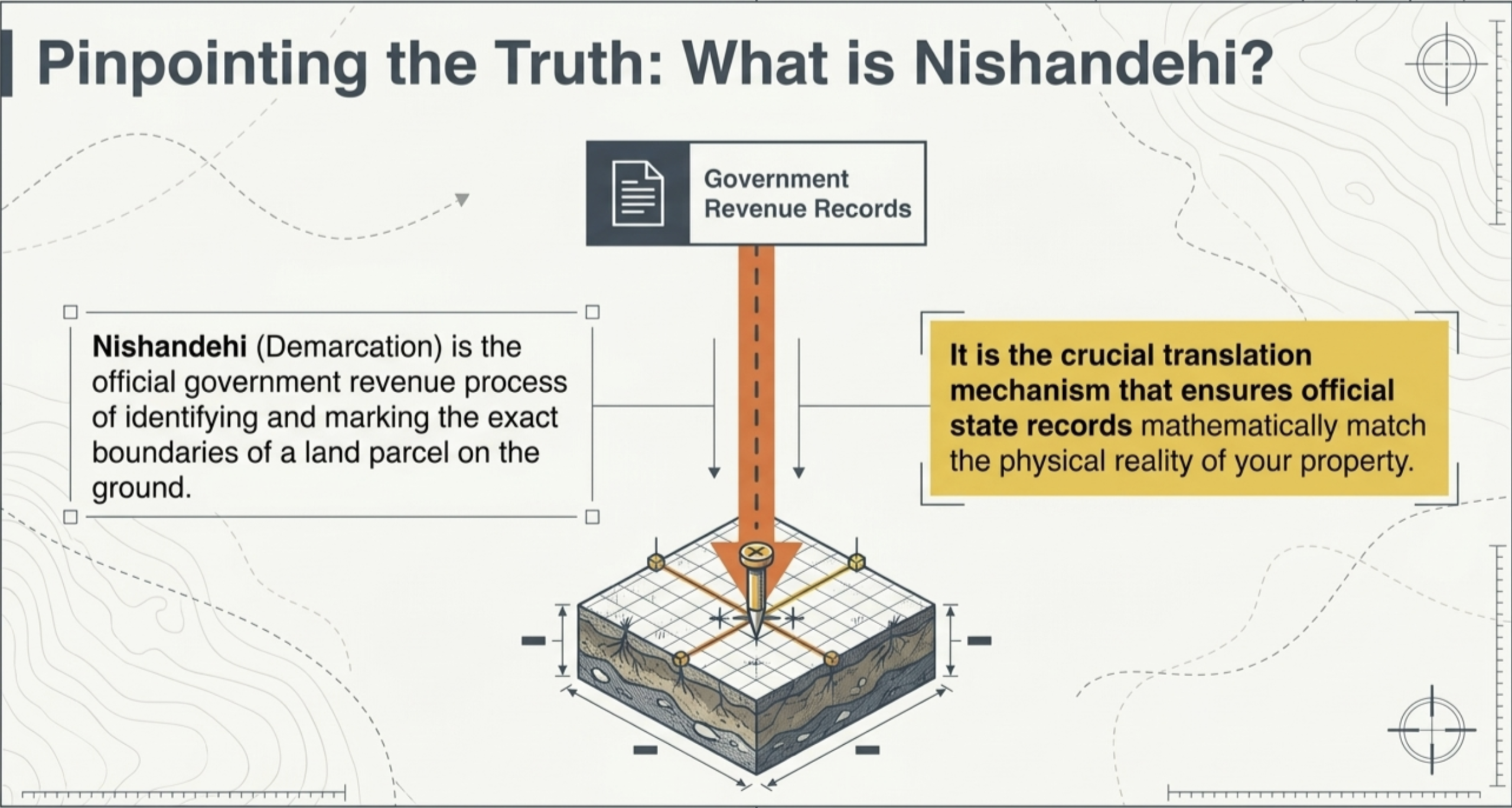
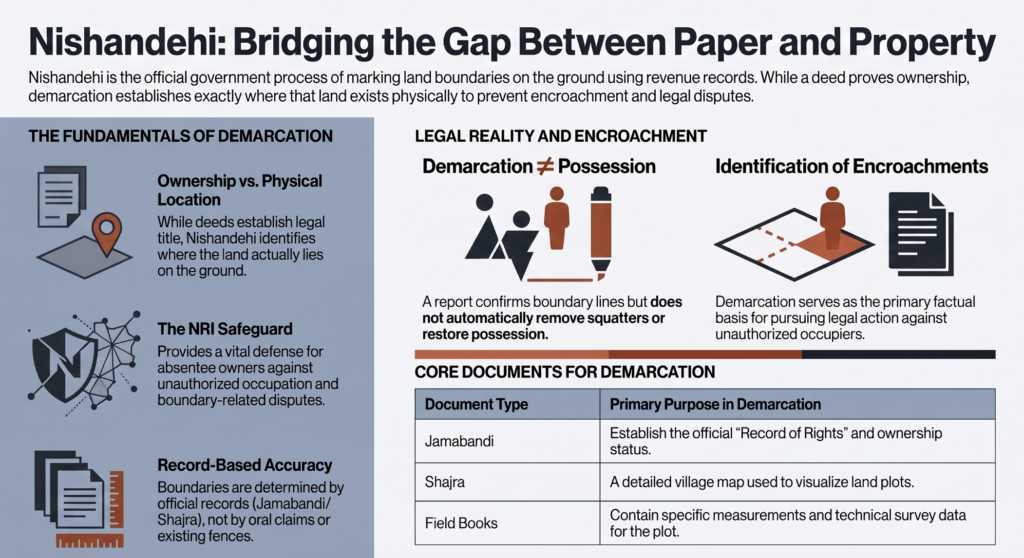
Nishandehi, a vital revenue process in India used to formally demarcate and mark the exact physical boundaries of a land parcel. It is a vital revenue procedure that helps identify exact land boundaries, resolve disputes, detect encroachments, and protect property rights. For Non-Resident Indians (NRIs), who are often unable to monitor their properties in India personally, demarcation serves as an essential safeguard for them against unauthorized occupation and boundary-related disputes.
Understanding the Concept of Nishandehi
Nishandehi is the official process of identifying and marking the exact boundaries and location of a parcel of land on the ground, as per government revenue records.
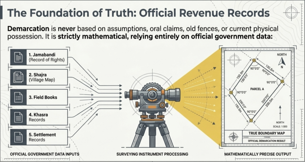
The process is undertaken by revenue authorities using records such as Jamabandi, Shajra, Field books, Khasra records, and other official land documents. Through measurement and verification, the authorities determine the precise location of the land and its boundaries.
While ownership documents establish legal title, Nishandehi establishes where the land actually lies on the ground. Consequently, it serves as an important mechanism for ensuring that revenue records correspond with the physical reality of property.
The Importance of Demarcation in Land Disputes
Boundary disputes are among the most common forms of land-related litigation. Over time, boundaries may become uncertain due to natural changes, missing markers, unauthorized occupation, or misunderstanding between adjoining landowners.
Demarcation provides clarity regarding the exact location of land and helps prevent prolonged disputes. It plays a significant role in:
- Identifying the true boundaries of property
- Detecting unauthorized occupation or encroachment
- Preventing future disputes
- Supporting legal proceedings involving land
- Facilitating peaceful resolution of boundary-related conflicts
- Protecting the interests of absentee landowners and NRIs
In many cases, a properly conducted demarcation becomes the foundation upon which subsequent legal proceedings are built.
Revenue Records as the Foundation of Demarcation
The demarcation process is not solely based on assumptions, oral claims, fences, walls, or existing possession. Instead, it is conducted with reference to official revenue records maintained by the government.
These records generally include:
- Jamabandi (Record of Rights)
- Shajra or village map
- Field books
- Khasra records
- Settlement records
- Other relevant revenue documents
The objective is to ensure that measurements conducted on the ground accurately reflect the position recorded in official records.
The Demarcation Process and the Role of Revenue Authorities
The process of demarcation generally begins with the submission of an application to the competent revenue authority. Upon receiving the application, the concerned officials examine the relevant revenue records and issue notices to affected parties, including adjoining landowners. A date is then fixed for conducting the demarcation on the spot.
Revenue officials, including Patwari, Kanungo and Tehsildar, visit the site and carry out measurements in accordance with the applicable revenue rules and records. Following the completion of measurements, a report is prepared recording the findings and identifying the boundaries of the land.
Throughout the process, the objective remains the accurate identification of land in accordance with official records rather than the determination of ownership disputes.
Identification of Encroachments through Demarcation
One of the primary reasons landowners seek demarcation is to determine whether any part of their property has been encroached upon. Where measurements reveal that a portion of land recorded in the name of one person is under the occupation of another, the demarcation report may indicate the existence and extent of the encroachment.
For many landowners, particularly NRIs, demarcation serves as the first step in establishing whether unauthorized occupation has occurred. It provides a factual basis upon which further legal action may be pursued.
A common misconception is that demarcation cannot be conducted if original boundary stones, survey markers, burjis, or pathars are no longer visible. In practice, the absence of a particular marker does not necessarily prevent demarcation from being carried out.
Revenue authorities may rely upon other available survey points, village maps, field records, and surrounding reference points such as roads, canals, bridges, culverts or railway lines, to reconstruct the boundary location. Measurements are typically connected with recognized survey points and official records to ensure accuracy and reliability.
Demarcation of Disputed Land Between Villages
Disputes involving land situated near the boundaries of two villages are often more complex than ordinary boundary disputes between individual landowners. Such disputes frequently arise when the land recorded in the revenue records of one village physically extends into the territorial limits of another village.
Such situations are not resolved merely by physical possession or long-standing occupation. Revenue authorities examine village boundary records, Hadbast records, settlement maps, Shajras, field books and other relevant revenue documents to determine the official boundary between the villages. Measurements are conducted with reference to recognized survey points and village records before identifying the location of the disputed land.
Where a discrepancy is established, the competent authority may restore the original boundary and make necessary corrections in the revenue records so that the disputed land is reflected in the records of the village to which it legally belongs.
The primary objective is to ensure that village boundaries align with official revenue records and that neither village gains nor loses land, contrary to the established revenue position.
The Legal Difference Between Demarcation and Possession
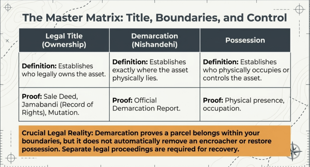
One of the most important aspects of land law is the distinction between demarcation and possession. Demarcation identifies the location and boundaries of land, whereas possession refers to the actual physical occupation or control of land.
A demarcation report may establish that a particular parcel of land falls within the boundaries of a landowner’s property. However, if another person is occupying that land, the report by itself does not automatically restore possession.
Accordingly, demarcation and possession are separate legal concepts, and additional proceedings may be necessary where recovery of possession is sought.
Challenging an Incorrect Demarcation Report
Although a demarcation report carries significant evidentiary value, it is not beyond challenge. Affected parties may raise objections where:
- Proper notice was not provided
- Revenue records were incorrectly applied
- Measurements were conducted improperly
- Relevant procedures were not followed
- Material errors exist in the report
Where valid grounds exist, appropriate remedies may be pursued before the competent authorities or courts in accordance with applicable law.
Protecting NRI Property Through Timely Demarcation
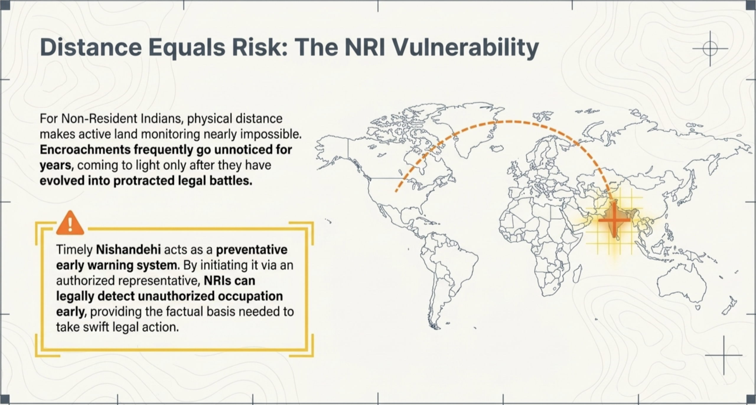
For NRIs, property management presents unique challenges. Physical distance often makes it difficult to monitor land, verify boundaries, or detect encroachment at an early stage.
As a result, disputes frequently come to light only after substantial time has passed. By obtaining a timely demarcation, NRIs can gain clarity regarding the status of their property and take appropriate legal action wherever necessary.
Demarcation, therefore, serves not only as a revenue procedure but also as an effective preventive measure against future disputes and unauthorized occupation.
To conclude, Nishandehi is a fundamental component of land administration and dispute resolution. By identifying the precise location and boundaries of land according to official revenue records, it provides clarity, certainty, and legal support in matters relating to property.
Whether the issue involves boundary disputes, suspected encroachment, inter-village conflicts, missing survey markers, or the protection of NRI’s property, demarcation often represents the first and most important step toward safeguarding land rights.
A properly conducted demarcation not only helps establish the true position of land on the ground but also provides a strong foundation for resolving disputes and protecting property interests in the future.
For more information regarding title verification and ownership of property contact NRI Legal World: info@nrilegalworld.com / +919709692096
Frequently Asked Questions
Q.) What is the purpose of Nishandehi?
Ans.) Nishandehi is conducted to identify the exact location and boundaries of a piece of land according to official revenue records. It helps landowners verify their property boundaries and detect any encroachment or boundary-related disputes.
Q.) Can an NRI apply for Nishandehi without coming to India?
Ans.) Yes, an NRI can apply through a valid Power of Attorney holder or an authorized representative. This allows the demarcation process to be initiated and completed even if the landowner is residing abroad.
Q.) Is Nishandehi necessary if I already have a sale deed and Jamabandi?
Ans.) A sale deed and Jamabandi establish ownership, but they do not physically identify the land on the ground. Nishandehi helps to determine the exact location and boundaries of the property according to revenue records.
Q.) Can Nishandehi help identify encroachment on my land?
Ans.) Yes, if a neighbouring land owner or any other person has occupied part of your land, the demarcation process may reveal the existence and extent of the encroachment.
Q.) Does Nishandehi automatically remove an encroacher?
Ans.) No, Nishandehi identifies the boundaries of the land and may establish the existence of an encroachment. Separate legal proceedings may be required to recover possession or seek removal of the encroachment.
Q.) Can police assistance be provided during Nishandehi?
Ans.) Yes, where there is genuine apprehension of violence, obstruction, or breach of peace, police assistance may be requested to ensure that the demarcation proceedings are conducted peacefully.